MyView
- Provider integrations behind one search
- 17
- Sensor families: optical, SAR, hyperspectral, thermal
- 4
- Days of passes ahead, from public orbital elements
- 14
- Steps from area to tasking request
- 5
Area
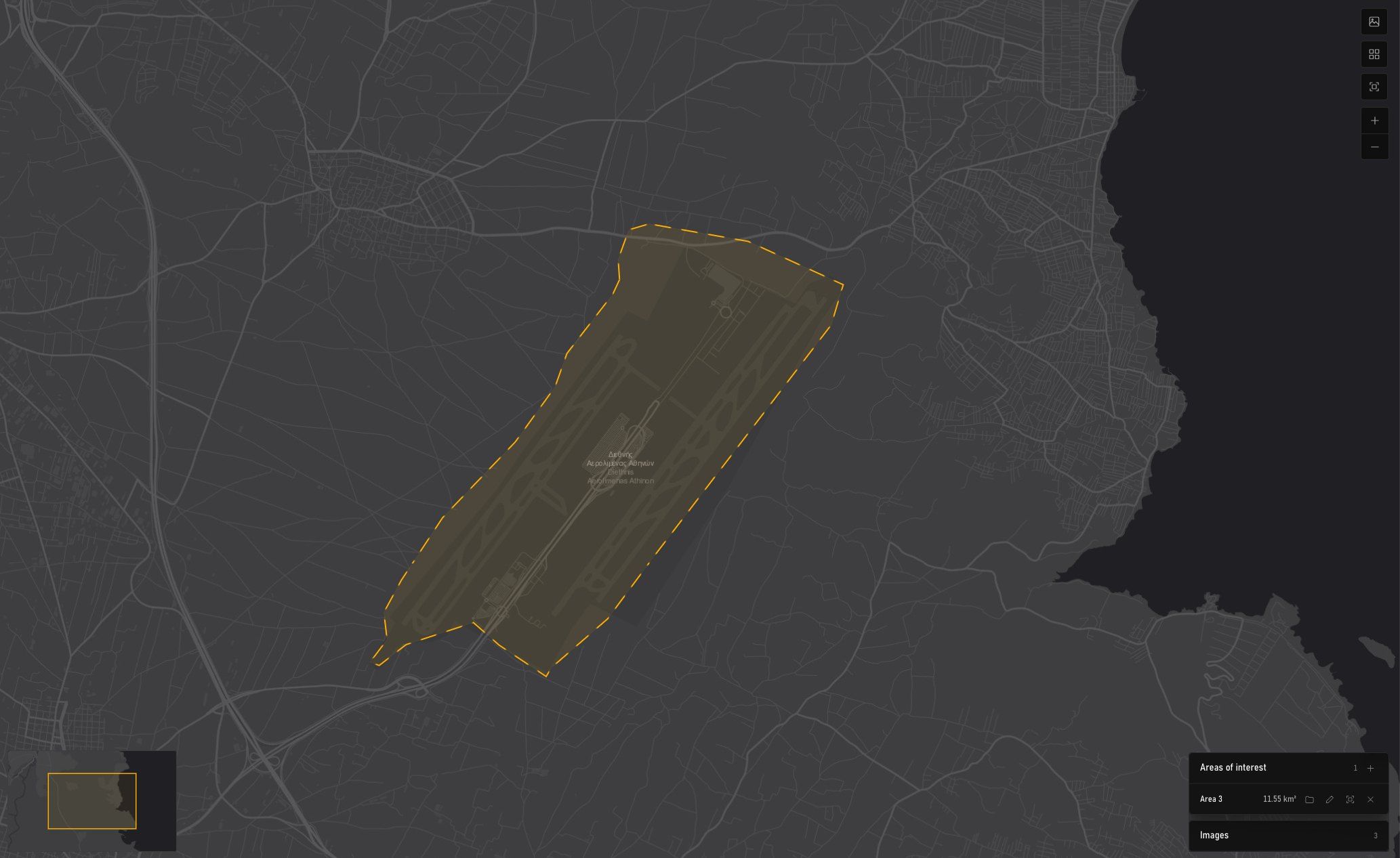
Box, polygon, place search or boundary file. Its size reads as you draw, and every module works from the active area.
- Box
- Polygon
- Measure
- Place search
- Boundary file
- Area 3
- 11.55 km²
- Stored as EPSG:4326
- WGS 84
Archive
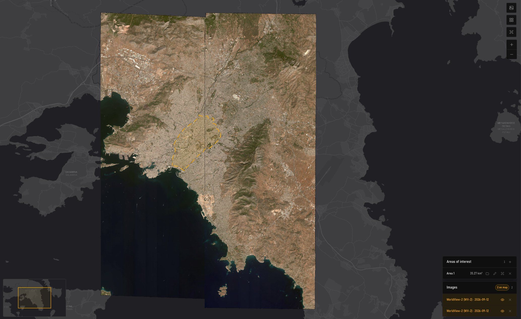
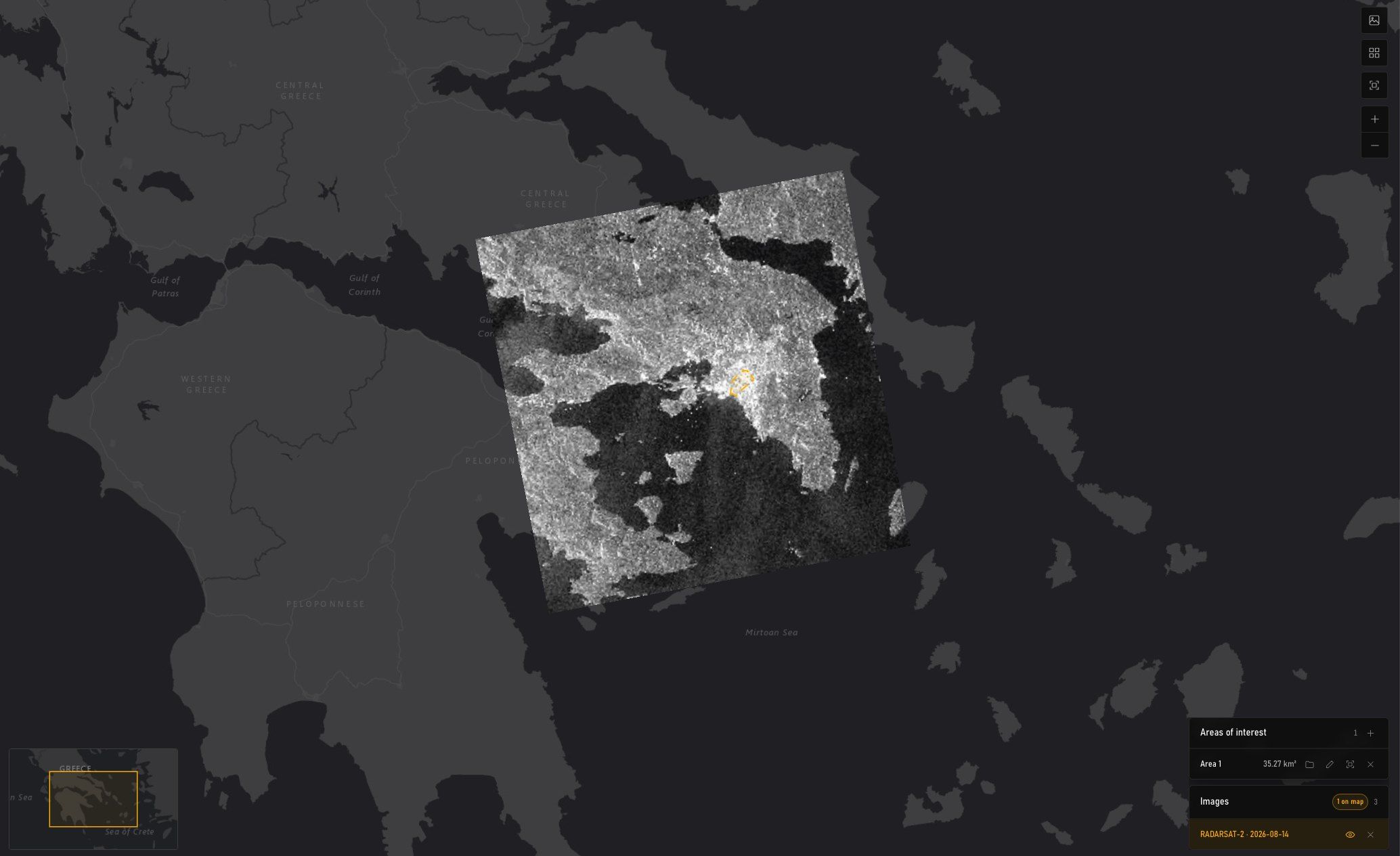
One search across every provider and every sensor family. Each card states time, sensor, pixel size, bands, angle, cloud, and how much of your area it covers.
- Sep 12, 202609:10 UTC · Vantor WorldView-2
- Pixel size
- 49 cm
- Bands
- 9
- Off-nadir
- 13.77°
- Cloud
- 0%
OPT32.74 km²92.8% of 35.27 km² - Sep 11, 202609:25 UTC · Vantor GeoEye-1
- Pixel size
- 45.2 cm
- Bands
- 5
- Off-nadir
- 19.01°
- Cloud
- 0%
OPT12.17 km²34.5% of 35.27 km² - Sep 14, 202609:38 UTC · Vantor WorldView Legion
- Pixel size
- 36.2 cm
- Bands
- 9
- Off-nadir
- 14.41°
- Cloud
- 15.2%
OPT3.67 km²10.4% of 35.27 km²
- Aug 14, 202616:19 UTC · MDA RADARSAT-2
- Pixel size
- 5.00 m
- Bands
- 1
- Off-nadir
- —
- Cloud
- n/a
SAR35.27 km²100% of 35.27 km² - Jun 27, 202616:19 UTC · MDA RADARSAT-2
- Pixel size
- 5.00 m
- Bands
- 1
- Off-nadir
- —
- Cloud
- n/a
SAR35.27 km²100% of 35.27 km² - May 10, 202616:19 UTC · MDA RADARSAT-2
- Pixel size
- 5.00 m
- Bands
- 1
- Off-nadir
- —
- Cloud
- n/a
SAR35.27 km²100% of 35.27 km²
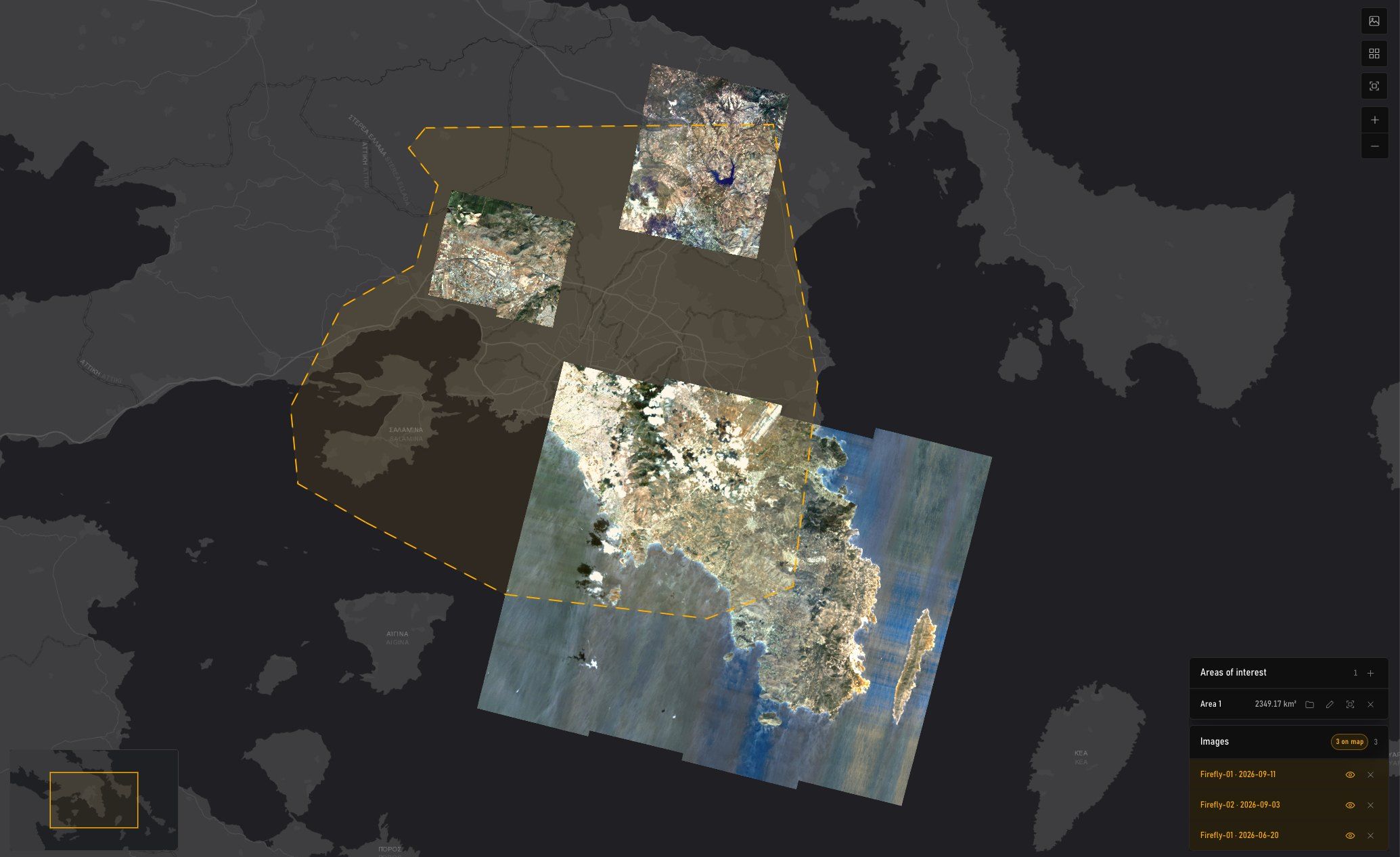
- Jun 20, 202609:41 UTC · Pixxel Firefly L2A
- Pixel size
- 5.00 m
- Bands
- —
- Off-nadir
- 22.25°
- Cloud
- 12.4%
HSI683.61 km²29.1% of 2,349 km² - Jun 11, 202609:35 UTC · Pixxel Firefly L2A
- Pixel size
- 5.00 m
- Bands
- —
- Off-nadir
- 9.90°
- Cloud
- 7.0%
HSI166.79 km²7.1% of 2,349 km² - Jul 14, 202609:38 UTC · Pixxel Firefly L2A
- Pixel size
- 5.00 m
- Bands
- —
- Off-nadir
- 14.74°
- Cloud
- 23.9%
HSI101.01 km²4.3% of 2,349 km²
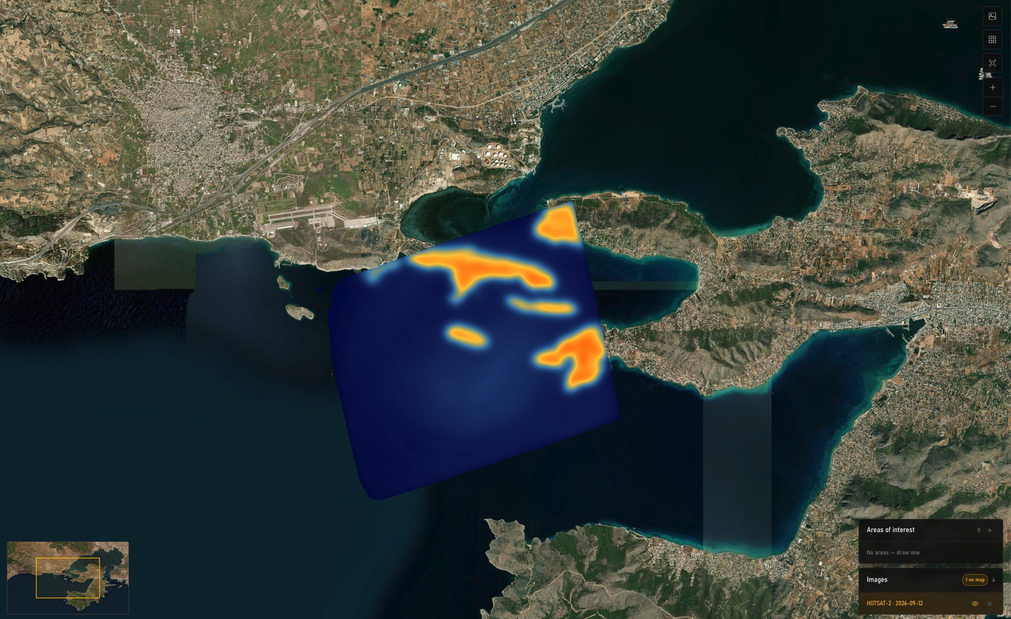
- Sep 12, 202612:52 UTC · SatVu HotSat
- Pixel size
- 4.18 m
- Bands
- 1
- Off-nadir
- 24.26°
- Cloud
- 0%
TIR23.49 km²1% of 2,349 km² - Jul 5, 202601:40 UTC · SatVu HotSat
- Pixel size
- 3.79 m
- Bands
- 1
- Off-nadir
- 14.84°
- Cloud
- 12%
TIR18.79 km²0.8% of 2,349 km² - Sep 3, 202601:31 UTC · SatVu HotSat
- Pixel size
- 3.57 m
- Bands
- 1
- Off-nadir
- 5.22°
- Cloud
- 25%
TIR16.44 km²0.7% of 2,349 km²
Passes
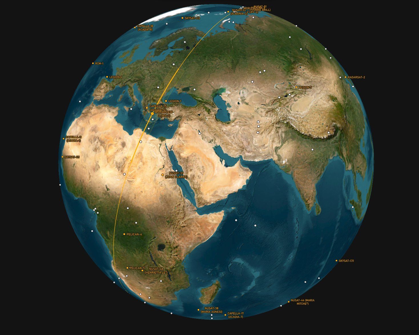
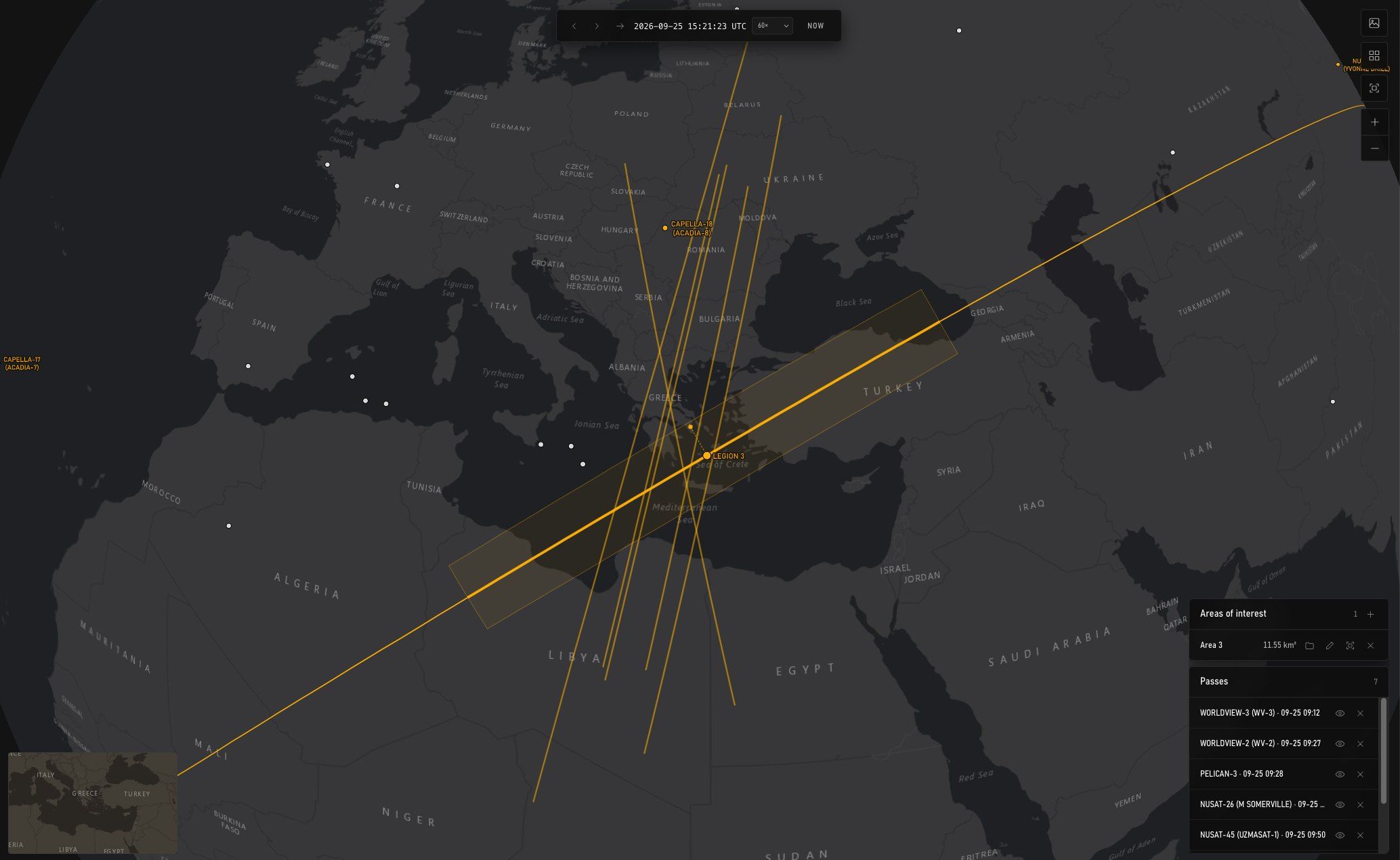
Every satellite over the area for the next 1 to 14 days, with its swath drawn on the globe at the moment of the pass. Task straight from the row.
- 09:12WorldView-3Vantor · 0.31 m · 13.1 km swath · off-nadir 13° · descending · ETask
- 09:27WorldView-2Vantor · 0.46 m · 16.4 km swath · off-nadir 18° · descending · WTask
- 09:28Pelican-3Planet Labs · 0.5 m · off-nadir 18° · descending · WTask
- 09:35NuSat-26Satellogic · 0.7 m · 5 km swath · off-nadir 5° · descending · ETask
- 09:50NuSat-45Satellogic · 0.7 m · 5 km swath · off-nadir 14° · descending · WTask
- 12:50NuSat-53Satellogic · 0.7 m · 5 km swath · off-nadir 9° · ascending · WTask
- 15:21Legion 3Vantor · 0.30 m · 10 km swath · off-nadir 18° · ascending · SETask
Daylight only · off-nadir up to 20° · 1, 3, 7 or 14 days
Next 3 days
- Optical107
- SAR93
- RF44
- Other3
Tasking
Five steps to a provider-ready request: what, when and within which bounds, how it is produced and delivered, and a summary before anything is committed.
General
- Type
- Optical
- Provider
- Vantor
- Area of interest
- Area 3 · 11.55 km²
- Priority
- Urgent: first opportunity, premium tier
Collection
- Window
- 2026-09-25 → 2026-10-02
- Resolution
- 15 cm
- Maximum cloud
- 8%
- Maximum off-nadir
- 7°
Projected passes
| Pass (UTC) | Satellite | Off-nadir |
|---|---|---|
| 2026-09-27 14:49 | Legion 3 NE | 2.7° |
| 2026-09-28 09:16 | WorldView-2 S | 1.0° |
| 2026-09-30 07:40 | Legion 5 NE | 1.0° |
The 3 soonest daylight passes within 7°, from public orbital elements. A projected pass says the satellite will be overhead; only the provider can say it will be pointed at you.
Production
- Product
- WorldView Legion Tasking, 15 cm HD
- Collection
- Vantor WorldView Legion
- Processing level
- Orthorectified
- Delivery
- Clipped to the area ordered
Delivery
- Destination
- Download link, e-mailed
- File format
- GeoTIFF
- Extent
- Clipped to the area requested
Summary
- Provider
- Vantor
- Product
- WorldView Legion Tasking, 15 cm HD
- Priority
- Urgent
- Area
- Area 3 · 11.55 km²
- Window
- 2026-09-25 → 2026-10-02
- Bounds
- Cloud 8% · off-nadir 7°
- Delivery
- Download link · GeoTIFF
Products
Analytics, mosaics and elevation models derived for the area, in the same cart as scenes. Each card states how it is delivered and billed.
- Capella Amplitude Change DetectionCapella Space · Mosaics
- Pixel size
- 50 cm
- Level
- L3
- Minimum area
- none stated
- Delivery
- whole product tiles
- LSTfusion, Level-3 UTM LSTconstellr · Mosaics
- Pixel size
- 30 m
- Level
- L3
- Minimum area
- 25 km²
- Delivery
- clipped to your area
- LSTzoom, LST, Emissivity & Surface Reflectanceconstellr · Mosaics
- Pixel size
- 10 m
- Level
- L3
- Minimum area
- 25 km²
- Delivery
- clipped to your area
- ALOS World 3D, 30 mMicrosoft Planetary Computer · Elevation models
- Pixel size
- 30 m
- Level
- DEM
- Minimum area
- none stated
- Delivery
- whole product tiles
Area 3 · 11.55 km²
API
Everything MyView does is available to your own systems through the MyView API: search, passes, tasking and orders from inside your GIS, portal or processing chain.
- Same catalogueEvery provider integration the app uses, behind one interface.
- Your interfaceSearch, task and order without leaving the tools your team already uses.
- Your accountOrders, licences and deliveries recorded against your organisation, as in the app.
Multiple sensors, one pass list.
Satellites from MyView’s pass lists over Attica for the week from 25 September 2026, and the thermal products listed for the same area. Not exhaustive.
Optical
Sunlit, sub-metre: the picture everyone expects.
SAR
Radar. Through cloud, day or night.
- ICEYE-X
- StriX · Synspective
- Acadia · Capella
- RADARSAT-2 · MDA
- RCM · CSA
- TerraSAR-X / TanDEM-X · DLR
- QPS-SAR · iQPS
- COSMO-SkyMed · e-GEOS
Thermal products
Land surface temperature, as a product.
Passes are computed from public orbital elements, so a satellite is listed whether or not we sell its imagery. The names above that link through are operators we hold an agreement with; the rest MyView tracks and nothing more. A pass on the list is not an offer to task.
Questions
Who can use MyView?
Access is by invitation. Ask us and we set up an account for your organisation.
How are orders priced?
On the part of each scene or product inside your area, unless the product states a minimum area or whole-tile delivery; the card says so before it goes in the cart.
Can I task every satellite in the pass list?
No. Passes are computed from public orbital elements, so the list shows everything overhead. Tasking goes only through operators we hold an agreement with.
Standard or urgent?
Standard is collected in the provider’s ordinary queue. Urgent is collected at the first opportunity, at the provider’s premium tier.
Can we connect our own platform?
Yes, through the MyView API. Ask for the documentation.
Can you run it for us instead?
Yes. Send the area and the question; our analysts search, task, process and send back the answer.
Access by invitation
Ask for an account for your organisation, or for the API documentation.