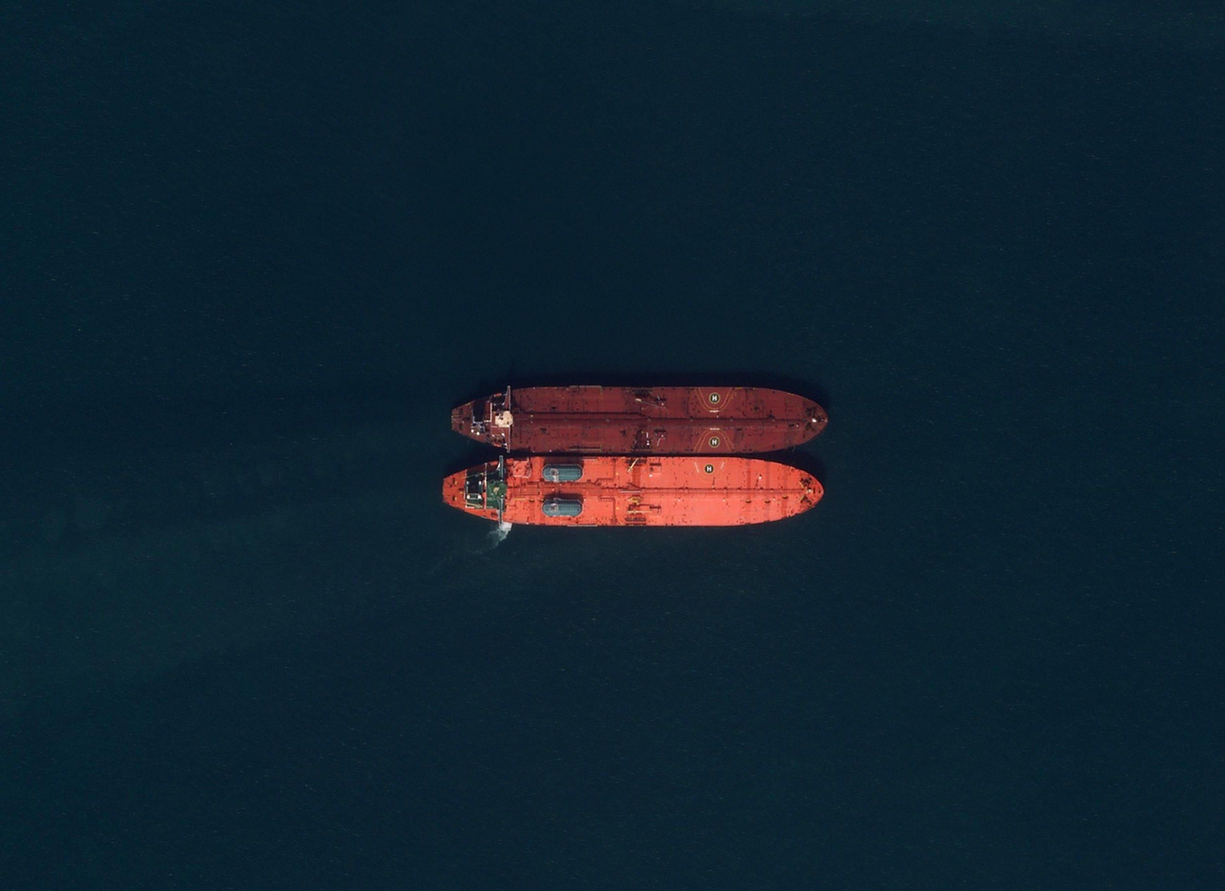
Vessel detection
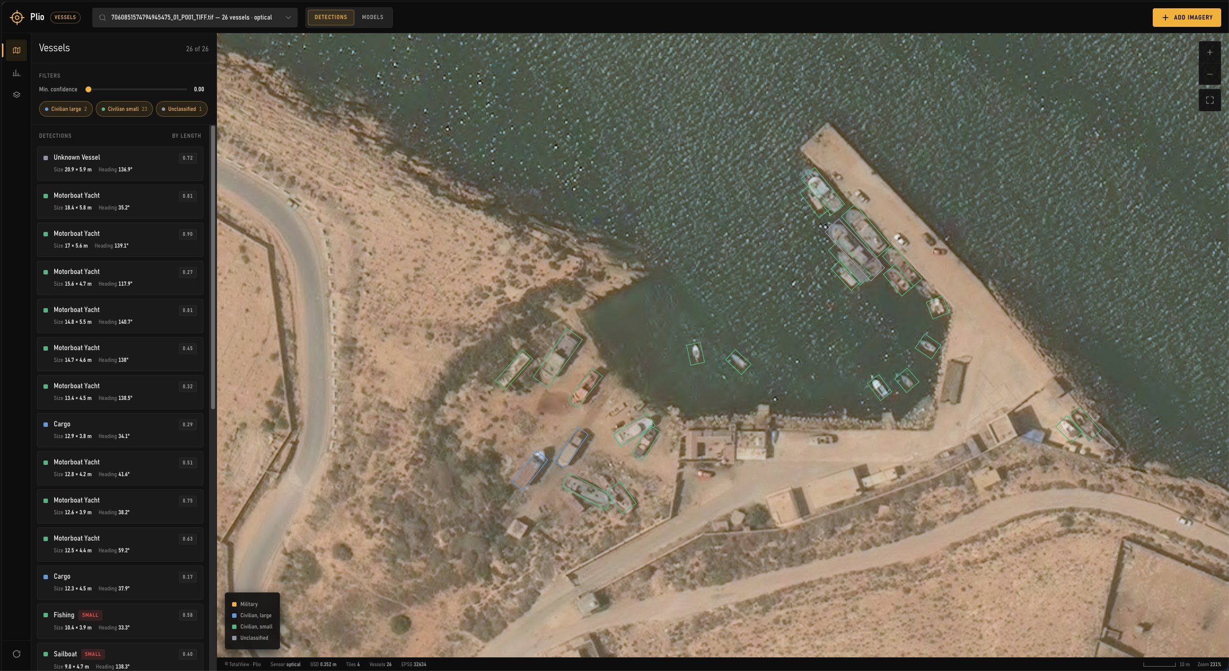
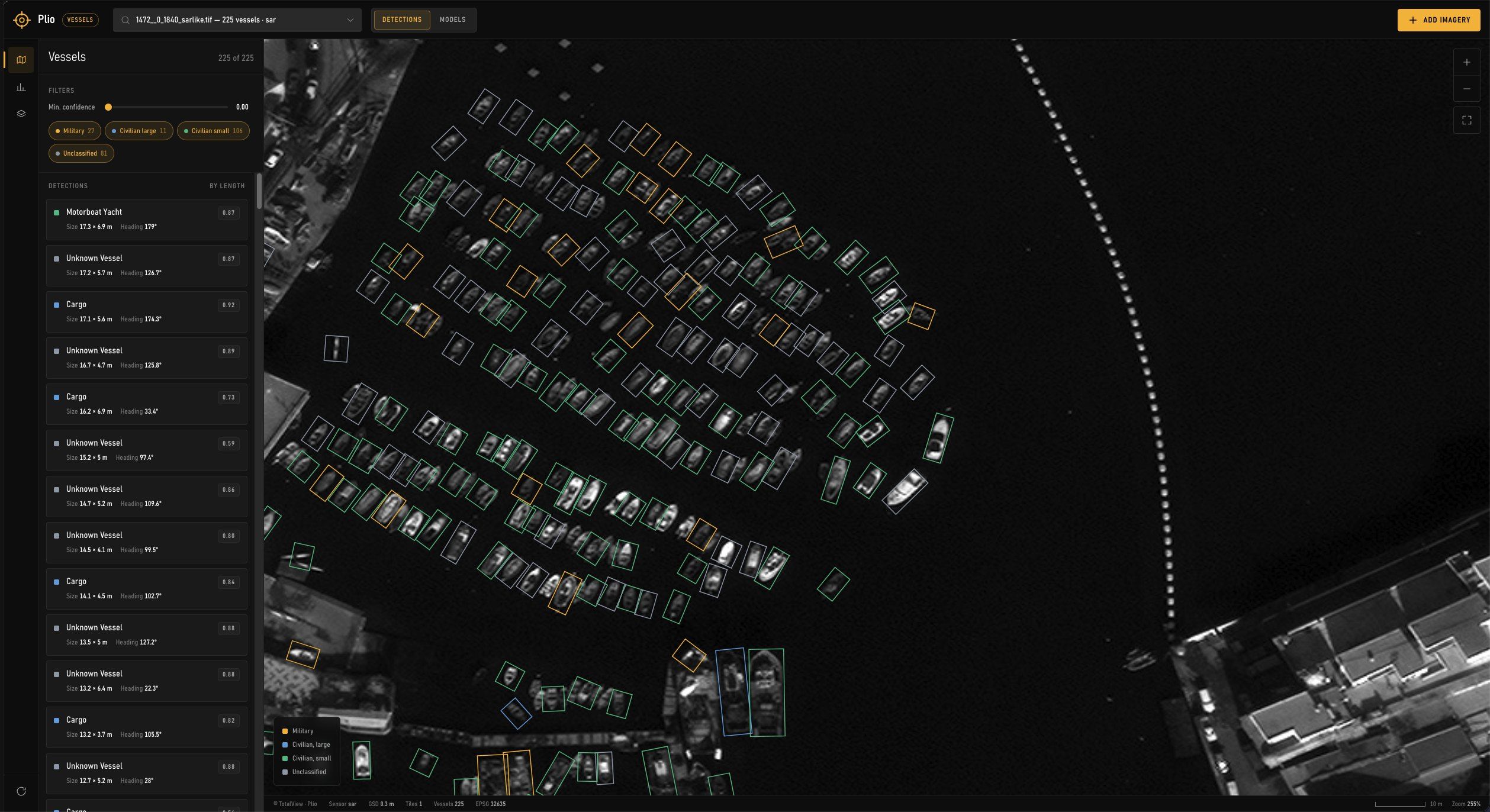
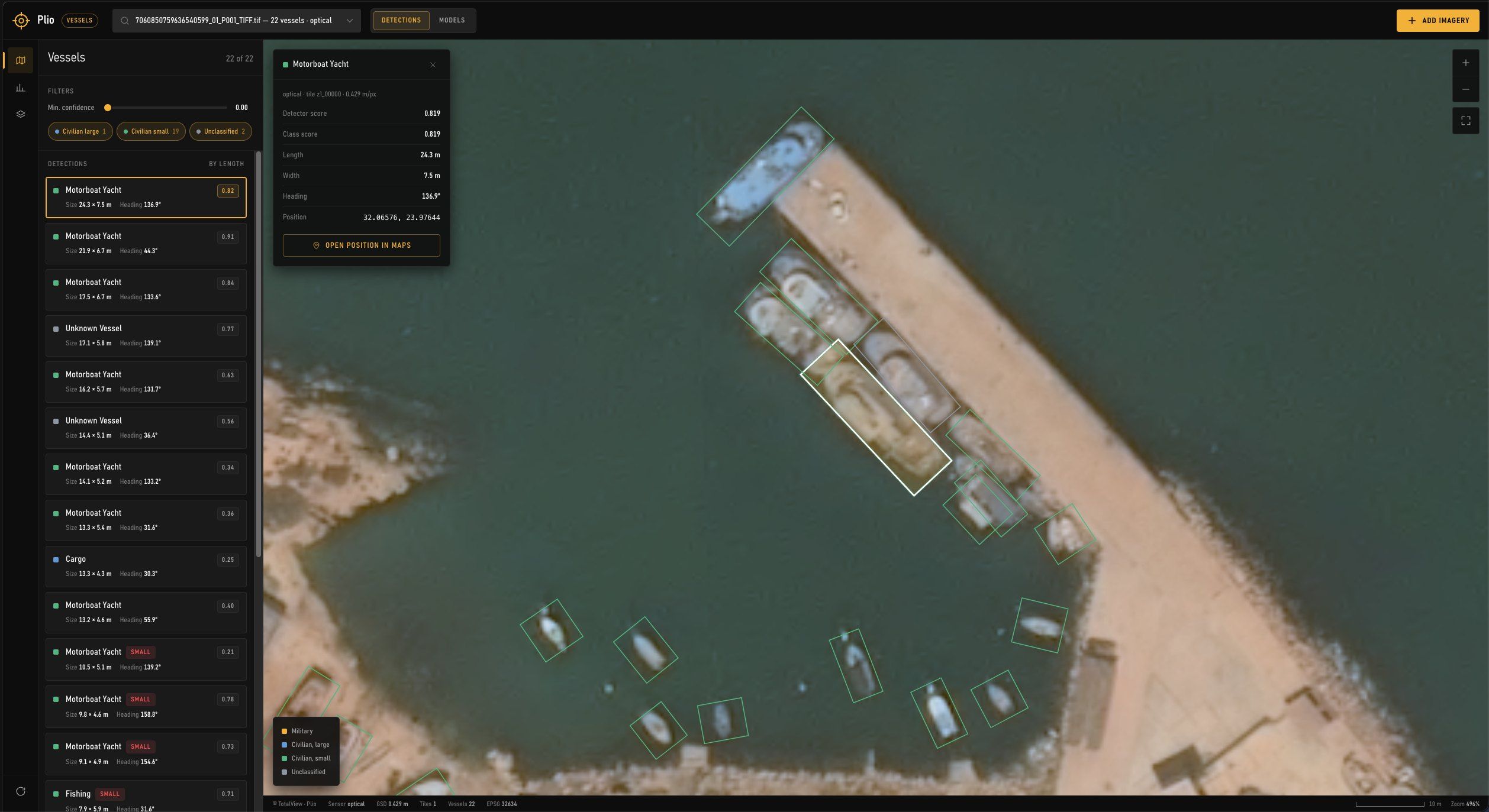
Ships detected, measured and classified on SAR and optical imagery by a machine learning model, and matched against AIS to expose dark vessels.
- 25 cmSAR · Umbra
- 25 cmSAR · ICEYE
- 30 cmOptical · Vantor
- 3 mOptical, daily · Planet
Plio
- Detection mAP@50
- 0.881
- Precision
- 0.867
- Recall
- 0.825
- Class, top-1 of 12
- 85.1%
Frozen test splits: 687 images for detection, 2,131 crops for classification.
12 vessel types, in three groups
- MilitaryNaval combatant, carrier, submarine, auxiliary, amphibious
- Civilian, largeCargo, tanker, passenger ferry
- Civilian, smallFishing, motorboat and yacht, sailboat, workboat
Applications
- 01
Defence and naval
Warships at sea and in port, naval base activity and fleet movements over time.
- 02
Dark vessels
Ships with AIS switched off or spoofed: detected in the image, absent or elsewhere in AIS.
- 03
Migration and search and rescue
Small boats at sea, for coast guard, border and rescue authorities.
- 04
Tankers and sanctions
Tankers at anchor, ship-to-ship transfers and loitering in high-risk waters.
- 05
Fisheries
Fishing vessels inside protected and closed areas.
- 06
Ports and shipyards
Vessels in port, occupied berths and docks, hulls under construction.
Per detection
| Field | Content |
|---|---|
| Position and time | Coordinates of the hull at the moment of acquisition |
| Outline | Hull outline as a polygon |
| Dimensions | Length and beam, in metres |
| Heading | Heading, and speed where a wake is visible |
| Type | One of 12 types in three groups: military, large civilian, small civilian |
| Scores | Detection and classification confidence |
| AIS | Matched MMSI and name, or flagged as dark |
| Image chip | The vessel cut from the scene, for review |
Workflow
- 01
Collection
SAR through cloud and at night; optical for identification
- 02
Detection
The model finds and outlines each hull
- 03
Classification
Length, heading and type per vessel
- 04
AIS matching
Paired with AIS at image time; unmatched vessels flagged as dark
- 05
Review
Analyst corrections retrain the models
Imagery by task
| Task | Imagery | Use |
|---|---|---|
| Wide-area search | SAR, 1–3 m | Large sea areas, day and night, through cloud |
| Small boats | SAR or optical, 25–50 cm | Coastal waters and approaches |
| Identification | Optical, 30–50 cm | Type, superstructure and deck features |
| Ports and bases | Optical and SAR, 25–50 cm | Vessels at berth, repeat counts |
| Emitters | RF | Radars and communications, geolocated |
Service
- 01
Single collection
One area and date: detections, vessel table and report.
- 02
Monitoring
Ports, straits or sea areas on a fixed schedule, with alerts on dark vessels.
- 03
Integration
Detections delivered into your maritime picture or command system, by API or files.
Users
- Navy and armed forces
- Coast guard
- Border and migration authorities
- Search and rescue
- Sanctions and compliance teams
- Fisheries inspection
- Port authorities
- Marine insurers
Delivery
- Detections
- GeoPackage, GeoJSON, Shapefile, KML
- Vessel tables
- CSV, one row per vessel
- Image chips
- GeoTIFF or PNG per vessel
- Online
- Layers and alerts in MyView